 |
| Sign at the trailhead for Cress Creek |
So, I grew up in Rexburg, Idaho but spent all my summers in West Yellowstone, Montana because my Dad owned and operated a summer theatre there. When you live in West Yellowstone, that means Yellowstone National Park is in your backyard. That seems infinitely cooler than Rexburg which is a small town surrounded by sagebrush.
I'm older now. Maybe a bit more mature but the jury's out on that one. In 1984, I left Rexburg and went to college and then grad school. After that I worked in Buffalo, New York and in the greater Seattle, Washington area. In 2000 two things happened that I never thought would. I got a job teaching at BYU-Idaho (formerly Ricks College where my Dad taught) and we moved back to Rexburg.
I have discovered since coming back that while West Yellowstone is a really cool place, Rexburg has it's own brand of cool. I had no idea, for example that within two hours of Rexburg there are 47 wild bird refuges just in the state of Idaho. If you drive just over the borders of Utah, Montana or Wyoming and still stay within that two hour radius there are many more. Who knew Idahoans were such avid bird watchers? I didn't. But I have become one lately. Of those 47 refuges, several of them are within literal minutes of Rexburg.
I was on a fact finding mission to a wild bird refuge the other day when I stumbled upon a trailhead for a place called Cress Creek. I stopped to check it out but didn't hike it that day. The reason I stopped is because I recognized it from a buddy's website. One of my friends has a website called
freearenas. I had seen the listing for Cress Creek on his site. There was a group of BYU-Idaho students just coming down from the hike and I asked them about it. One of the guys said the views of the Snake River Valley were breathtaking and I should really hike up there and watch the sunset from the top of the trail. Challenge accepted.
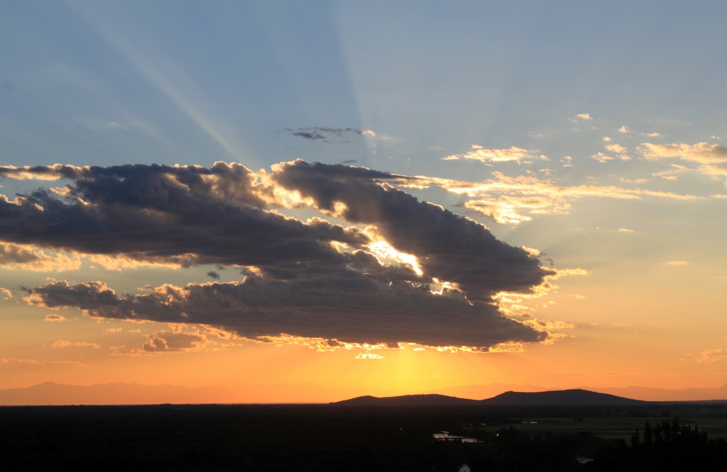
I didn't hike it that day, but went back a couple of days later with my favorite hiking buddy, the Hot Chick. I had told her I wanted to watch the sunset from Cress Creek Nature Trail. Here's another thing about Idaho. Southeast Idaho has some of the most spectacular sunsets I have ever seen. I have lived in Utah, Idaho, Montana, Washington, New York, Minnesota and Wisconsin. I'm telling you, the sunsets here are astounding.
We live on the valley floor, but when I was a kid we lived up on the Bench (which is the raised part of the Rexburg Fault) The sunsets from the valley floor are beautiful, but when you can view it from higher ground, well, it's like sunsets on steroids. We had to do it. We drove out to Cress Creek Nature Trail and began the hike. I have since done a little reading about the hike and how it came to be. Part of the land for the trail was donated by the Bybee family here in Rexburg and the rest I think belonged to the BLM. I also discovered that this trail was designated a "National Recreation Trail" in 2005. It just got cooler.
 |
| View from the trailhead of the canal in the foreground and the South Fork of the Snake River in the background. Notice the old stagecoach road barely visible on the left |
The first half mile of the trail is paved and is wheelchair accessible. All in all there are about eighteen interpretive signs along the trail. I didn't photograph all of them but I did get a few for the sake of the blog.
 |
| One of the first interpretive signs |
 |
| This sign inspired confidence |
 |
| There were benches strategically placed all along the trail, both the paved part and the dirt part. Typically the views of the valley were breathtaking where the benches were |
 |
| What the paved portion of the trail looked like |
 |
| Another interpretive sign |
Right at the trailhead, there was a sign about earthquake faults. The geologic feature locally called the Rexburg Bench is an uplifted plateau that has been pushed up by successive earthquakes. Either that or the valley has dropped, or maybe both. At the top of the first switchback another interpretive sign said that the grey rock on top of the other rock was deposited by a volcanic eruption. Volcanoes and earthquakes seem to go together.
 |
| There is an earthquake fault here (somewhere) |
 |
| Volcanic deposition |
 |
| I turned around and saw that the sunset was beginning. We started hiking just before the golden hour. Fair warning, this blog post is all about seeing the sunset from the trail, so there will be many sunset photos. You have been warned |
 |
| This is Cress Creek for which the trail is named. Cress Creek is named for the plant watercress which grows here year round because of the warmth of the water. In the dead of winter, the stream is still lukewarm and watercress grows green. Watercress is also a favorite food for moose. Didn't see any of them dang it. |
Once the paved trail ends, the dirt trail begins. This trail is well maintained, well groomed. They take good care of it. It's a big loop trail and I estimate something between two and three miles round trip. A pretty short hike. There are some steep places, but they are offset by the careful grooming of the trail. Also along the way are several short spur trails which go to the rim of the canyon for better viewing. At the highest point of the regular trail, another spur trail goes up to the top of the mountain. I'm not sure that spur trail is part of the BLM's designated trail or not, but people are encouraged to hike it if they wish. It is brutally steep, however.
 |
| SLR selfie on one of the spur trails. I really am that bald (and I don't care) |
 |
| This is a view of the largest cottonwood forest in the lower 48. This is an ecologically important area |
 |
| Oh look, another sunset picture |
 |
| The trail is very well maintained |
 |
| Texture along the trail |
 |
| These are the remnants of an old stagecoach or wagon road |
 |
| More |
 |
| View of the selfie spur trail from the highest point of the regular trail |
 |
| Golden hour light on the rocks |
 |
| Very scenic view of the South Fork of the Snake River |
 |
| The prickly pear cacti are beginning to bloom |
 |
| Sunset through the Utah Juniper trees |
 |
| The Hot Chick is demonstrating just how steep the unofficial spur trail is |
 |
| It was even steep for the stinkbug |
 |
| As we continued along the trail, the sunset became more spectacular |
 |
| Mariposa lily either beginning to bloom or closing up for the night. Dunno if they do that or not. |
 |
| Cress Creek. That's watercress by golly |
 |
| Yellow monkeyflowers |
We headed back around the trail and to the parking lot. The sunset kept changing until finally it went out. This was a beautiful and informative hike. We enjoyed it a lot and will likely hike it again. Sometimes we hike to see a waterfall, or a petrified forest or a glacial lake, but on this day we hiked to see a spectacular sunset. Mission accomplished.
 |
| Sunset |
 |
| Just about finished |
You always expect to learn something from an experience like this. I learned that Idaho is Cool




.jpg)
.jpg)
.jpg)
.jpg)
.jpg)
.jpg)
.jpg)
.jpg)
.jpg)
.jpg)
.jpg)
.jpg)
.jpg)
.jpg)
.jpg)
.jpg)
.jpg)
.jpg)
.jpg)
.jpg)
.jpg)
.jpg)
.jpg)
.jpg)
.jpg)