|
| My boys at the base of Upper Fairy Falls |
I mentioned the book, The Guide to Yellowstone Waterfalls and Their Discovery in an earlier blog post. It's a book that references 300+ waterfalls in Yellowstone National Park. I purchased a copy and have been reading it and carefully laying my plans to see as many of them as I can. I've seen around thirty. I think one hundred is a doable goal. Yellowstone is a wonderland, in fact it used to be called that many years ago. Everybody knows about the hot water in Yellowstone but most people don't realize how much cold water there is in the park. There is something for everyone in Yellowstone.
Fairy Falls has always been one of our favorite hikes. I think I discovered it when I was a teenager and introduced it to my family. When the Hot Chick and I got married, I introduced it to her and some members of her family as well. We hike in to Fairy Falls every three or so years now. Back in the seventies, Fairy Falls wasn't nearly as popular as it is today. I was told that at some point the touring companies started advertising Fairy Falls in their brochures and after that the trail has been inundated with people. I like people but they are not the mammals I go to see in Yellowstone, so we try to hit the trail early in the season or late when there are less humans around.
From the waterfall book I discovered there are two waterfalls upstream of Fairy Falls on Fairy Creek. That seemed like a good place to start.
The Hot Chick was out of town so it was just me and my two youngest sons. We headed up to Yellowstone on the third of July to do a little hiking. As per usual, the trail to Fairy Falls was packed with people. The parking lot was full to overflowing. The trail to the falls is about two and a half miles and the first mile is along an old stagecoach freight road. I didn't take many photos of the trail to Fairy Falls because I've already blogged about that trail
here.
 |
| Hot pool at the trailhead to Fairy Falls |
 |
| Another thermal feature along the trail |
 |
| Bog orchid near Fairy Falls |
 |
| Fairy Falls |
There is a social trail up a hill along the Fairy Falls Trail that overlooks Grand Prismatic Spring. The trail was open last year when we went and got a great view of one of the iconic sights of Yellowstone. Sadly, a tourist last year was doing something he shouldn't have and had an accident up there and died. The Park Service has closed the hill to climbing now because of it. There are signs all along the trail that say no hiking, but when we hiked by, the hill was swarming with people trying to get that great view of Grand Prismatic Spring. I am one who likes to obey the law because it's the right thing to do and because it makes my life less complicated, so we did not hike up the social trail.
I believe the Park Service should figure out a way to formalize the trail and even construct a viewing platform at the top of the hill. They could do what they have done at Canyon on the Red Rock Trail and build a wooden staircase up the hill to a viewing platform. I have found references all over the internet about that social trail and nowhere online have I found that it is closed now. People are planning vacations around that hike because the information is out there. The Park Service is either going to have to permanently station a ranger at that point to cite people who climb up, or just accept the fact that they are going to, or better yet, formalize a real trail that is safe and practical. If they did that, the honeycomb network of trails that exist on that hill can be restored to their natural state. That's what would happen if I ran the world.
I found that most of the people on the trail did not go all the way to Fairy Falls. Most of them ended up on the social trail. When we got to Fairy Falls there were about twenty people, give or take. We hung out at the falls for a bit before we decided to hike up to Upper Fairy Falls, and while we were there, people came and went but there were always between fifteen and twenty people there.
So, now comes the silly part. I bought the book, and I read it, but I thought I knew what was what and I took a trail up the plateau that looked like it would get me to where I was going. It did, but it was not the trail that the authors of the book had written about. There is supposedly an easier trail to Upper Fairy Falls than the one we took. The trail we found was a social trail immediately to the west of Fairy Falls. The correct trails is a game trail about two hundred yards east of Fairy Falls. Next time I hike this, I will find that game trail.
Our trail was very steep until about halfway up, then it was a near vertical rock climb the rest of the way. The good news was that there were plenty of handholds and toeholds to get us up. The bad news was that we were going to have to climb back down.
I recommend that you only attempt the climb we made if you are a seasoned rock climber. Do not attempt this if you have no prior climbing experience.
The steep part of the hill was about forty-five degrees. It was steep.
 |
| The slope |
 |
| This is where the social trail went |
 |
| The view of the valley was stunning |
 |
| The near vertical rock climb |
 |
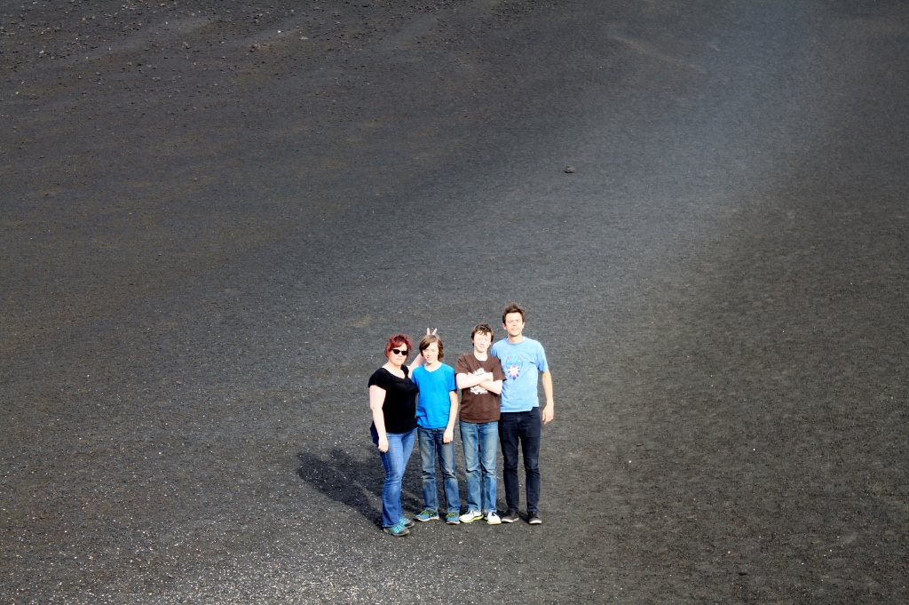
| Looking down at the pool at the base of Fairy Falls. Notice how little the people are. They look like ants. There were more people than show in the picture. There were people hidden by the green hillside. |
Once we cleared the rock climb, we had to bushwhack across the top of the plateau in the direction of the creek. As we got closer, we began to hear rushing water. We were very close. When we got to the location, it seemed the best approach was from the east, so we crossed the creek and descended into the small canyon where Upper Fairy Falls resides. It did not disappoint.
 |
| The first view of Upper Fairy Falls |
Once we were there, we decided first to go see the brink of Fairy Falls. It is a 150 foot dropoff. I will admit that peering over the edge, even though we laid down on the rock and inched our way toward the cliff, was at the same time exhilarating and terrifying. I would do it again. It was obvious we were not the first people to have done so.
When we had exhausted our curiosity about the brink of Fairy Falls, we went back and hung out at Upper Fairy Falls for a half an hour or so. It was just too pretty to leave. I noticed something white and manmade at the bottom of the falls, though. I sent the boys over to retrieve it and it turned out to be a bottle of Axe body wash. I almost instantly remembered a poem from my college days. I can't remember the poem but the gist of it was a man climbing a hill he believed had never been seen by man before and reveling in the undisturbed nature of it and in the last stanza finds a broken mason jar lid on the ground. I wish I could remember that poem.
So we took the Axe body wash and hiked it out and threw it away. I wondered as we did so if it belonged to a backpacker who had left it there with the intent of coming back and bathing in the stream. I'll never know, but there may be a stinky hiker out there somewhere now.
The contrast between the base of Fairy Falls and Upper Fairy Falls is striking. The upper falls lie within a small canyon and because of that a micro climate has been formed. It's almost a mini rainforest. You don't really expect to see a lot of ferns in Yellowstone, but they were abundant here. So were the wildflowers.
 |
| The brink of Fairy Falls |
 |
| What Fairy Falls looks like from above |
 |
| The actual brink |
 |
| About ten feet upstream of the falls |
 |
| Here'e Upper Fairy Falls from the base. Beautiful |
 |
| Lewis Monkeyflowers were abundant |
 |
| So were ferns |
 |
| I was there too |
 |
| More monkeyflowers |
 |
| Boys in their natural state |
 |
| The micro-climate |
Whenever possible, I like to photograph a waterfall from all sides, the base, the side and the brink. We climbed out of the mini canyon and walked across the rock wall that formed the falls and found the brink of Upper Fairy Falls and I photographed it.
By this time, we had waterfall fever and the only prescription was finding more waterfalls. The literature said there was one more waterfall upstream about a half mile. The authors of the book called it Fairyslipper Falls because of the rare and beautiful and still elusive to me Calypso Orchid, AKA the Fairyslipper Orchid. To date, Fairyslipper Falls is the only feature in Yellowstone named for the Calypso Orchid. I missed the blooming window again this year, so I'll have to wait for another year to see one. The quest continues.
As we hiked up the next canyon the half mile to Fairyslipper Falls, we noticed the entire canyon floor was boggy. There were plenty of deadfall trees in the canyon so we were able to walk along them and keep our feet dry. More importantly we didn't wish to disturb the wetland we found there. The closer to Fairyslipper Falls we came, the more the bog turned into mini or micro springs feeding Fairy Creek.
We had hiked almost a half mile and were looking around for the waterfall. We couldn't see it, nor could we hear it. Then we came across a large rock barrier at the mouth of the canyon and decided it must be there. As we hiked up, however, we couldn't see any falling water. The creek did drop many feet in cascades though and I wondered if this was what they considered Fairyslipper Falls.
There were springs everywhere and one of them was about a foot wide and fell at least fifteen feet in a horsetail waterfall into Fairy Creek. I wondered if this was Fairyslipper Falls. I determined to press on to the barrier though just in case because I thought I remembered from the book that Fairyslipper Falls was a fifteen foot plunge.
When I arrived at the rock wall I didn't find any falling water, but I did find a natural spring ejecting at it's base which I determined to be the headwaters of Fairy Creek. I wondered if Fairy Creek was like the Little Lost River and the Big Lost River in Idaho, which is an active river during the spring but after the snowmelt is exhausted, the river isn't robust enough to overcome the porosity of the soil and sinks into the desert only to spout from the cliffs a hundred miles further in Shoshone Canyon.
At the right of the rock wall was a telltale pool and a stream channel but no waterfall. I began to piece together Fairyslipper Falls.
 |
| The Brink of Upper Fairy Falls |
 |
| The unnamed canyon between Upper Fairy Falls and Fairy Falls, photographed from the brink of Upper Fairy Falls |
 |
| Above Upper Fairy Falls. Stuff like this was everywhere |
 |
| Stuff like this was everywhere too |
 |
| Wyoming Paintbrush, formerly known as Indian Paintbrush |
 |
| The bog between Upper Fairy Falls and Fairyslipper Falls. the deadfalls were our path |
 |
At first I thought this was an orchid (there are seventeen native orchids in Yellowstone)
But after researching, I discovered it is a bog wintergreen. So named because it keeps
it's green foliage all throughout the winter |
 |
| More of this stuff |
 |
| Boys and high places. It's like a magnet to them. I was a boy once |
 |
| There should be a waterfall here but there's not |
 |
| Seeps and springs like this abounded though |
 |
| micro waterfall, was this the elusive Fairyslipper Falls? |
 |
| Part of the cascades that ran from the rock face down fifty or so yards. Was this the elusive Fairyslipper Falls? |
 |
| A spring ejecting from the base of the cliff |
 |
| The telltale pool |
 |
| Another spring. They were everywhere here. |
 |
| Boys in their natural state. Pretty sure I'll get in trouble when the Hot Chick sees this one. |
I climbed around the rock face after my boys did and found a dry creek bed. I followed it down to the rock face and found a dry waterfall at the spot just above the telltale pool. The mystery of Fairyslipper Falls was solved. Fairyslipper Falls is a temporary falls. I wanted to follow the dry creek bed back to see if there is an active stream that sinks into the ground like the Lost Rivers in Idaho but we didn't have time to do so. I believe there is a small window of opportunity to see this waterfall, between the time the area is open after bear activity in the spring and when the creek dries up.
After I got back to the car, I looked up Fairyslipper Falls and found a picture of where it should have been. The authors of the book didn't make mention of the fact that this is a temporary falls, which led me to the conclusion that I know something they don't! They probably saw this waterfall early in the season and assumed since Fairy Falls is a permanent waterfall that Fairyslipper Falls must be as well. The authors of the book make mention of many temporary falls in the park and so I don't think at the time of publication they didn't know.
 |
| The brink of the now dry Fairyslipper Falls |
 |
| View from above. Lewis Monkeyflowers in the foreground |
 |
| The telltale pool from above |
 |
| This whole canyon is a boggy seep full of springs feeding Fairy Creek. The authors made reference to that |
 |
| Those boys again |
We headed back down the plateau, and while the climb up wasn't bad, the climb down was more dicey. I mentioned I hadn't checked my facts before we left, rather I just went with what I thought I knew. I let my pride get in the way and the climb down was kind of scary. We made it which could give us a false sense of security, but rather, I know none of us were experienced enough rock climbers to make this descent. We went very slow and picked each handhold and toehold very carefully. I went first and stood below my sons at every point of the descent to ensure their safety. I had to balance getting down in daylight with getting lost at night in bear country. I chose getting down. I would not choose this route again, at least not until I was a more experienced rock climber.
I do not recommend this route either.
Instead, wait until I find the easier, safer route later this year and I'll blog about that. I purposely did not take any photos of this route because I don't want to show where it is.
We came down on the trail we went up on and when we reached the bottom, Fairy Falls was deserted. We had it all to ourselves. Some friendly hikers had left us a neat cairn though.
We hung out at Fairy Falls for a half an hour all to ourselves and waded in the pool. Then we headed back to the car and went into Old Faithful for the obligatory Ice Cream. On the way home, we decided to run over to Great Fountain Geyser to see if it was going to blow. My app said it was due. The App gives a plus or minus 2 hours for Great Fountain, and we caught the tail end of the eruption. Just a little play in the cone, nothing more than ten feet. Still, it was beautiful to see it in the sunset. I have officially added "See Great Fountain Geyser erupt at sunset" to my bucket list.
 |
| Cairn left by friendly hikers |
 |
| Fairy Falls with golden hour light |
 |
| Geyser runoff near the trailhead |
 |
| Great Fountain at sunset, tail end of the eruption |
I had a great time with my two sons. We love the outdoors and we love seeing new things. I wish to find the easier route to Upper Fairy Falls, I wish to take the Hot Chick there. I wish to see Fairyslipper Falls with water running off of it. I wish to see Great Fountain erupt at dusk. That's the problem with Yellowstone. When you see something new and exciting it makes you hungry for more.
Nirvana!