.jpg) |
| Trailhead for Terraced Falls and Cascade Creek |
July 4th, 2014, we started our day watching our son march in the Independence Day parade with the Summer Band, then we did the next most natural thing in the world, we went on a hike in Yellowstone.
 |
| My son playing in the summer band on the July 4th parade |
 |
| Oh, and I touched a camel |
So far this year we had been through all the thermals in the major geyser basins, we had been to Canyon, we had been to Mammoth and Lake, Tower and the Lamar Valley. We had been to the south entrance and Grand Teton National Park. We had even driven nine hours one way to see Glacier National Park. Ironically, the one part of Yellowstone we had not been to was the corner nearest our home, otherwise known as Cascade Corner or Bechler. Cascade Corner is so named because of the preponderance of waterfalls in that section of the park.
The Bechler area of Yellowstone is the least developed of all the areas in the Park. Except for trails and an occasional bridge, Bechler looks for all intents and purposes the same as it did the first time an explorer of European descent ever laid eyes upon it. There is a primitive beauty and naivete in this corner of the park that is missing in so many other areas. It is also the area of the park that I have least traveled. With how much we love to hike and how much we love waterfalls, I think that needs to change.
This is a remote part of the park, so it makes sense that it's not terribly easy to get to. We headed north on Highway 20 and just before the town of Ashton, Idaho we turned east on 1200 North. 1200 North is barely marked with a small street sign and at this point has no indication that the road becomes anything else. Just a road out into the dryfarms around Ashton. After ten or so miles of straight road over rolling hills and past hundreds of acres of seed potatoes, the road becomes a dirt road and there is an indication that it is the Ashton/Flagg Ranch Road. The dirt road goes on for five or six miles and is relatively straight and has grader marks in it so it is bumpy but not bad. After that, the road narrows quite a bit, some places only allowing one car to pass. At this point, the road isn't maintained very well and is twisty and bumpy.
The paved road is 45 mph, then the first leg of the dirt road goes to 35 mph and then the windy, bumpy part was slow going. I don't recall how many miles it was on the bumpy road, but we were on dirt for at least a half hour or more before we reached the trailhead. It was okay though because the bumpy road was balanced with some spectacular scenery and fields of wildflowers. From the dirt road on, the road parallels the southern border of Yellowstone National Park.
When we arrived at the trailhead, there were several cars already parked there and we encountered some hikers just returning. They were park employees on their day off and told us how spectacular the trail was. One of them pointed out a very short spur trail from the parking lot to an overlook of Cascade Creek.
.jpg) |
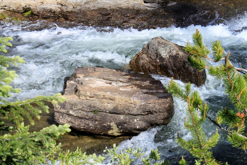
| First view of Cascade Creek. This was a taste of what was to come |
.jpg) |
| Downstream from the same vantage point |
Over the millenia, this creek has cut it's channel through the Huckleberry Ridge Tuff that is so prevalent around here. The tuff is left over from the last catastrophic eruption of the Island Park Caldera. There are three calderas in the area. The Island Park Caldera is the largest and the Henry's Fork Caldera and the Yellowstone Caldera fit inside of it. I'm not sure which of these caldera events produced this particular tuff. All along the canyon, though the tuff has weathered into large hoodoos and pinnacles so the landscape has an otherworldly quality to it.
The Trail
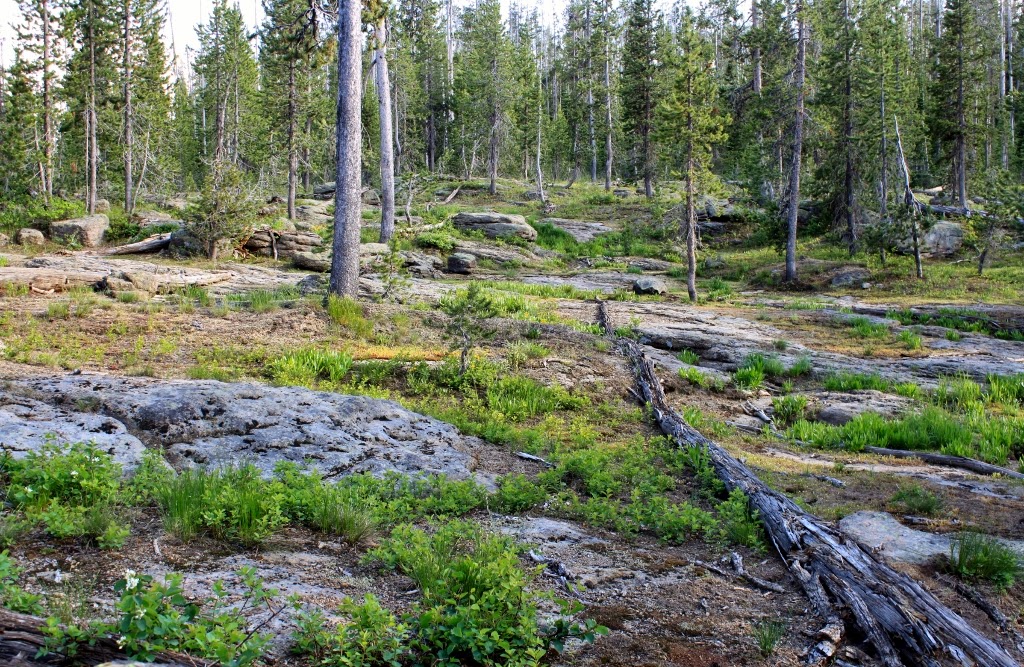
The trail was easy as trails go. Very little elevation gain or loss. The trail guides say about 200 feet of elevation gain. The 200 feet of gain was spread out over the two miles of this trail so it was never really a challenge. Most of the trail was shaded by 3 pm when we entered the forest. It was a combination lodgepole pine and cathedral fir forest. Because of all the water in this part of the park, there was a significant amount of undergrowth which you don't always see on trails in Yellowstone.
We descended into the canyon and about a half mile into the hike we entered Yellowstone National Park. Shortly after that we began encountering waterfalls. Most of the waterfalls were of the fifteen to twenty foot drop varieties but there were some larger. I didn't bother to count the waterfalls because they were so abundant.
The trail hung to the creek bank, alternating between ten and forty feet away from the running water for most of it. This was a fast moving stream but it was relatively shallow so I wasn't terribly concerned about anyone falling in or washing downstream. It was a fast stream but not violent.
Shortly into this trip, I realized that it would probably be a small lens day for the camera. I took very few closeups, mostly landscape stuff. I love the zoom lens, but it wasn't very useful on this trip.
.jpg) |
| A random passing stranger took this photo of us so there is evidence that I was on this trip |
.jpg) |
| The trailhead |
.jpg) |
| Just to give an idea what you will be hiking through |
.jpg) |
| Half a mile in we entered Yellowstone |
.jpg) |
| Bend in the river before the fun really starts |
.jpg) |
| Now that's a big beaver! |
.jpg) |
| Serendipitous shot. |
.jpg) |
| My son on a tree |
.jpg) |
| What the trail looked like |
.jpg) |
| First real set of cascades |
.jpg) |
| And they continue downstream |
.jpg) |
| The trail got smaller |
.jpg) |
| Two tiered cataract |
.jpg) |
| Boys standing on a rock, attempting to appear disinterested. They failed |
.jpg) |
| Another small waterfall |
.jpg) |
| This waterfall was a bit larger. A portent of things to come |
.jpg) |
| Same vantage point as the last picture, shooting downstream. The cliff walls were typical for the whole hike |
.jpg) |
| A waterfall following a waterfall! |
.jpg) |
| Wider shot of the same system |
.jpg) |
| Closer shot of the upper waterfall |
.jpg) |
| Downstream, another waterfall |
.jpg) |
| Then there were a few wide ones like this |
.jpg) |
| Downstream from the last pic, the waterfall splits around an island in the river |
.jpg) |
| Not sure what this wildflower is, I'll identify it later |
.jpg) |
| Another view of the same falls |
.jpg) |
| Hoodoos along the water's edge |
.jpg) |
| The diciest part of the trail. It narrowed here and there was a dropoff to a steep slope |
.jpg) |
| First view of the Upper Terraced Falls |
.jpg) |
| Rainbow in the mist |
.jpg) |
| Same falls, different vantage point |
.jpg) |
| More waterfall action |
.jpg) |
| Another falls on the trail |
.jpg) |
| The canyon beyond the last waterfall on this hike |
.jpg) |
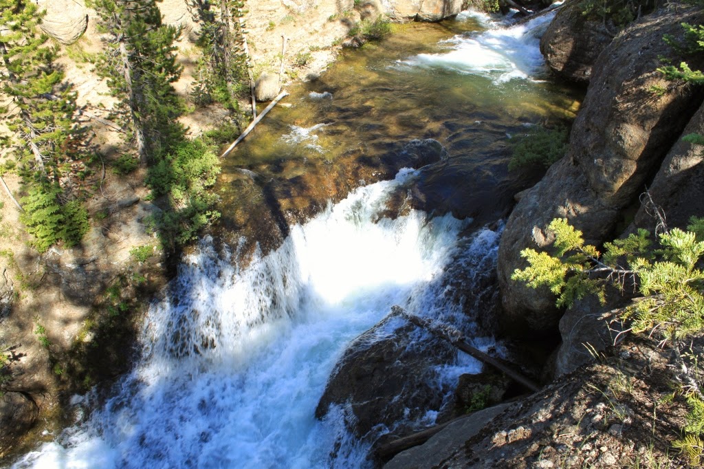
Lower Terraced Falls. No good view from the base, so the best views
are from hoodoo boulders on the brink |
.jpg) |
| Rainbow at the lower falls |
.jpg) |
| Pinnacle hoodoos from the lower falls |
.jpg) |
| So I like hoodoos |
.jpg) |
| View of the Lower Terraced Falls |
Backtracking to the Car
We headed back after hanging out at the lower falls for awhile. The best views of this falls were from the boulder hoodoos on the side of the canyon wall. It was at least a seventy foot drop, maybe more from where I was to the canyon floor. It was humbling and liberating all at the same time. We headed back and I worried a bit more about some of the other sights along this trail.
.jpg) |
| The fam on the trail |
.jpg) |
| Moss on a boulder |
.jpg) |
| I liked the light play on the underbrush here |
.jpg) |
| Elk track. The first evidence of large mammals we saw on this trip |
.jpg) |
| Moss |
.jpg) |
| This weird red asparagus looking stuff was all over the place. Don't know what it's called though |
.jpg) |
| I think I missed this one on the way in |
.jpg) |
| Every now and then it looked like this |
.jpg) |
| More hoodoos |
.jpg) |
| Random trail cairn |
.jpg) |
| Elk bones. The only other evidence of large mammals we saw on this trip |
The Road Home
We were in a bit of a hurry to get home because we wanted to attend a block party and light money on fire for a cheap thrill, so we didn't stop much for photos. We got behind a slow moving truck for part of it, though so I found a place to pull over to take some shots to get some distance between his dust and us.
.jpg) |
| Hillside of weathered Huckleberry Ridge Tuff |
.jpg) |
| I'll have to identify this later. It might be special it might not |
.jpg) |
| Don't know this one either |
.jpg) |
| Scarlet Gilia |
.jpg) |
| On the vine |
Conclusion
This was perhaps the highest concentration of falling water features I have ever seen in so short a distance. It was a nice day with family and it is a hike I will definitely do again. I thought this was a great day.
LOVED IT!!! Beautiful Waterfalls!!! Looks like a Wonderful way to spend the day with your family!!! I guess Tyler wasn't there this time??
ReplyDeleteNaw, Tyler is in Philly right now, selling pest control. He's ripping it up out there. It was a very easy two mile in hike. Never have I seen so many waterfalls in such a short time.
ReplyDelete