.jpg) |
| Sign at the trailhead |
The Hot Chick suggested we go on a hike last Tuesday. She also suggested I find a hike for us to go on. We like waterfalls and a friend of mine had recommended the Osprey Falls hike. I investigated it and decided it was everything I wanted it to be.
I was preparing to hike Tablerock in the Tetons later that week so I was looking for a hike that would be strenuous enough to replicate in small measure what I'd be up against at Tablerock. The Osprey Falls trail seemed to have everything I wanted in a hike
All the trailguides I read suggested it was an 8 mile round trip with between 700 and 800 feet of elevation gain. The Huckleberry trail to Tablerock was 14 miles round trip with 4000 feet of elevation gain. So the numbers don't really compute, but it was really the elevation gain and loss on the Osprey Falls trail that was the clincher. It was all 800 feet in less than a mile. Very similar to some of the extreme elevation gain on the Huckleberry trail to Tablerock.
I attempted this hike to see if I was in good enough physical condition to attempt Tablerock. Mission accomplished!
Step 1: Getting There
We left our home around ten o'clock AM and drove up to Yellowstone on Highway 20. There is road construction in several places between our home and West Yellowstone, so the normal one and a half hour trip became a solid two hours.
We did stop at Howard Springs and the Lewis Monkeyflowers were in bloom. Had to stop for that.
Within the first four miles inside Yellowstone National Park, I spotted a black vulture sitting on a charred tree that had been burned in the fires of 1988.
We headed north from Madison Junction to Norris Junction and then on towards Mammoth. There was road construction between Norris and Mammoth, so we did have to wait for a short time and then drive slowly. It probably added between fifteen and twenty minutes to the trip. Not too bad but there are many other things I'd rather do than sit in road construction.
The trailhead to Osprey Falls is situated just before descending the canyon and the Golden Gate into Mammoth Hot Springs. The trailhead is shared with the Bunsen Peak trail as well. Once we got there, we strapped up, booted up, covered up and shot up with mosquito dope and sunscreen.
.jpg) |
| Lewis Monkeyflowers |
.jpg) |
| Lewis Monkeyflower closeup |
.jpg) |
| Black Vulture |
.jpg) |
| An unidentified wildflower seen at Sheepeater Cliff |
Step 2: The Old Stagecoach Road
First of all, I don't know for sure if this was an old stagecoach road, but it probably was. At one point it was paved because we saw some decayed asphalt in a couple of places. All the original roads in Yellowstone were stagecoach roads and when the main automobile roads came into place, they either paved over the old stagecoach roads or found alternate routes and the stagecoach roads became trails or service roads. Because of where this road begins and where it terminates, I believe it to be an old stagecoach road.
The trailguides and the signs don't agree on total mileage. The Hot Chick has an app on her phone that ties GPS coordinates to routes walked to give you an accurate mileage count. The trailguides say it's eight miles round trip and the sign says 4.6 miles to Osprey Falls. When the hike was done, the app said our round trip hike was just under eleven miles. The trailguides have a large disparity between elevation shift as well. It all depends on where they start and end I suppose. The app said that for the whole hike, instead of 500 feet or 700 feet or even 800 feet, our total shift in elevation was around 1200 feet. I think the trailguides calculated the total descent from the rim of the canyon and the app calculated the total descent from the trailhead. I suppose that could account for a little disparity.
The stagecoach road to the spur trail for Osprey Falls was approximately four miles. It was a gentle trail with a little altitude gain but very gentle. The trail wound through wildflower meadows around the base of Bunsen Peak and was sandwiched between that and Sheepeater Canyon. Here and there the trail passed through small forests of lodgepole pine. At about the four mile mark, the stagecoach road began a steep, winding descent into Sheepeater Canyon. For approximately 100 yards the trail lost about a hundred feet of elevation. This is where the spur trail to Osprey Falls broke off the main road. The stagecoach road continues it's descent down Sheepeater Canyon and apparently connects with the main road a mile or two later.
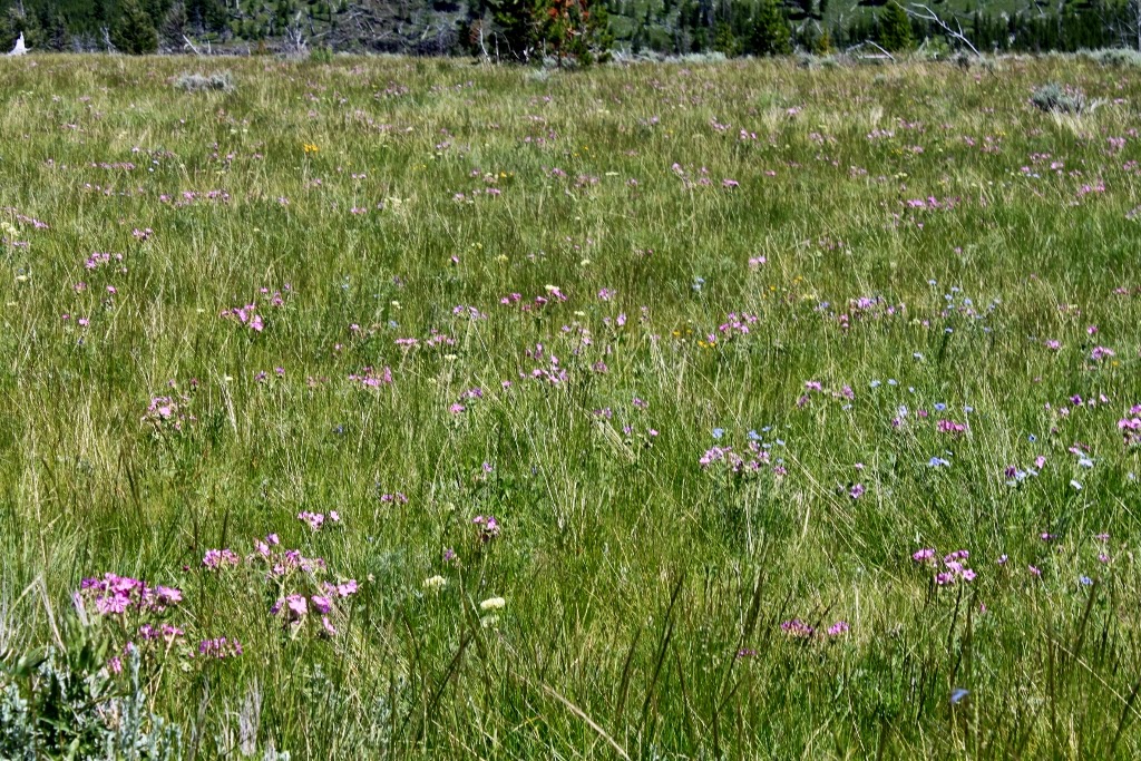
Wildflowers along the first part of the trail were primarily blue flax, sticky geranium, ox-eye daisy and silver lupine. There were others here and there, but these were the ones that made the biggest splash. I decided to shoot with my small lens going down the canyon and then at the bottom switch to the zoom. It made sense to do it that way so I didn't have to pack the camera case with me. I stowed the big lens in my pack and then switched at the bottom. I think it worked out well. Going down I was more interested in the wide shots and coming up I was interested in the details.
.jpg) |
| Slough at the trailhead |
.jpg) |
| Blue flax |
.jpg) |
| Stagecoach road with Bunsen Peak in the background |
.jpg) |
| Looking back along the trail, where we had come. The mountains were spectacular |
.jpg) |
| Evidence of the fires of 1988 |
.jpg) |
| Small pond along the trail |
.jpg) |
| The Hot Chick at the pond |
.jpg) |
| Bunsen Peak |
.jpg) |
| The stagecoach road |
.jpg) |
| First view of Sheepeater Canyon |
.jpg) |
| Sheepeater Canyon with silvery lupine in the foreground |
.jpg) |
| Geraniums and flax |
.jpg) |
| Looking back, shows slight elevation gain and loss. It was like this for four miles |
.jpg) |
| Larry, a passing cyclist swapped photos with us. We took one of him with his camera and he took one of us with ours. Nice people in the backcountry of Yellowstone. |
.jpg) |
| Sign just before the stagecoach road dips into Sheepeater Canyon. It originally said, "Steep Grade." Someone scratched the "D" off and replaced it with a "V". Then I saw vultures circling... |
.jpg) |
| Sign to the spur trail |
Step 3: Rim Trail
After the steep descent, the spur trail broke off the stagecoach road and followed the rim of the canyon for a half mile or so. Maybe more but certainly not less. This trail passed through forest and meadow and often was right at the edge of the second deepest canyon in Yellowstone National Park. This trail did nothing to prepare us for what was to come. It did offer spectacular and dramatic views of Sheepeater Canyon though. I counted at least four different igneous layers of columnar jointed basalt exposed in the canyon walls. I'm sure there were more buried deeper beneath the hundreds of feet of talus.
.jpg) |
| Second sign at the trailhead. There was an iron bar for cyclists to secure their bicycles. |
.jpg) |
| Wooded trail, mix of shady and not. Wildflowers everywhere |
.jpg) |
| Exposed stone in some places on the trail. |
.jpg) |
| The trail went right to the canyon rim on several occasions |
.jpg) |
| That large pillar of free standing columnar jointed basalt is directly across from Osprey Falls. We didn't know this at the time. |
.jpg) |
| This stuff was everywhere |
.jpg) |
| The trail continued on along the rim through forest and shade |
.jpg) |
| Dramatic views of the river in the canyon |
.jpg) |
| First view of what was in store for us. These are brutally steep switchbacks in places |
.jpg) |
| Quite the scenic canyon |
.jpg) |
| Where the rim trail ends and the switchbacks begin |
Step 4: The Switchbacks
Besides seeing something new, the switchbacks were what I came on this trail for. I knew They would be similar to the switchbacks on the Tablerock Trail. I needed to see if I was up to the hike. These switchbacks were steep and gravelly. Several times the Hot Chick skidded and had to right herself and so did I. There were places where the trail was literally one foot wide with the canyon wall on one side and a dropoff into the canyon on the other.
I did some of the math in my head based on the Hot Chick's phone app and decided we descended 800 feet in about 3/4 of a mile. Those numbers are give or take but close.
In the top third of the canyon, I saw several wild roses in bloom. I decided I'd shoot them when I ascended. When we came out of the canyon, I looked all over for them but only saw the bushes. Apparently some of the hikers who exited the canyon as we descended believed they needed to pick the roses more than I needed to shoot them. I saw several different varieties of penstemon in this canyon as well. There were several invasive plants as well.
At the end of the switchbacks, the trail wound around a large boulder and when we rounded the corner we caught our first glimpse of the falls. We had heard them for awhile but to see them through the trees was pretty cool. The trail went on for a hundred yards more to the base of the falls. Spectacular!
.jpg) |
| The Hot Chick on one of the first switchbacks |
.jpg) |
| The Hot Chick at one of the turns. Yes it was that steep |
.jpg) |
| The Hot Chick at a particularly steep part of the trail |
.jpg) |
| Evidence that I was on this hike as well |
.jpg) |
| Narrow trail, dropoff on the right |
.jpg) |
| Rugged |
.jpg) |
| Four distinct layers of igneous activity |
.jpg) |
| I like the Hot Chick |
.jpg) |
| The boulder just before the falls. Note the elevation difference between me and her |
.jpg) |
| Free standing pillar of columnar jointed basalt directly across from Osprey Falls |
.jpg) |
| First view of the falls |
Step 5: Osprey Falls
Osprey Falls is a thunderous waterfall that falls 150 feet into Sheepeater Canyon. This has become one of our favorite areas in the park, and now with our discovery of Osprey Falls, it just got cooler.
There is a place to the side of the falls where you can sit and ponder in the shade. The hike to the falls was pretty hot, so the mist from Osprey Falls was refreshing. We ate our lunch in the bottom of the canyon, thinking we would need some energy on the way out. Turns out we were right. Our new friend, Larry the cyclist was down at the bottom enjoying the falls. Once again, we traded photos with him.
We stayed at the falls for almost an hour. We enjoyed the falls, we ate and we rested. We had to psyche ourselves out for the ascent.
.jpg) |
| The Hot Chick at Osprey Falls |
.jpg) |
| There was a convenient rock where you could get a really good shot of the falls |
.jpg) |
| Larry the cyclist took this pic for us |
.jpg) |
| Small cave near the falls, a good picnic site |
Step 6: Changing Lenses and Hiking Out
I changed lenses in the bottom of the canyon to photograph details on the way out. On a longer hike, I think this makes sense. Shoot the wide stuff on the way in and the details on the way out.
This was where the rubber was to meet the road. At the end of this hike I would know if I could ascend Tablerock in two days. When I reached the canyon rim I told the Hot Chick that I believed I could climb Tablerock. This was a good test for me. Tablerock was a longer hike and one that had more elevation gain, but the switchbacks on the Osprey Falls trail were just about as rigorous as the most difficult part of the Tablerock trail.
We made the rim and back to the stagecoach road. We hiked out of the canyon around 5 PM and made the car at around 7:30 PM. I noticed several wildflowers, such as the flax punch a timeclock and wind themselves up in the evening when the sun stops being productive for them. That was interesting to me.
We (I) hoped to see a large mammal on the trail, such as a bear, bison, moose or elk. We (I) was disappointed with that. We saw a yellow bellied marmot on the canyon rim and several small varmints at the end of the stagecoach road near the trailhead.
We did see evidence of large mammals though. There were multiple buffalo chips, elk tracks and a rotted log that had been rendered by a bear looking for grubs. After we got to the car and drove out, we saw a small herd of elk in the meadow. They were near the trail but a small knoll kept them from our view.
As we drove out of the park, near seven mile bridge, there was a brilliant sunset that I could not pass up. Neither could several other people. There were several cars stopped and all the people were out taking photos of it. Awesome.
.jpg) |
| Moss on the rocks |
.jpg) |
Houndstongue. Pretty plant, but is a non-native noxious weed. Accidentally
introduced from Europe |
.jpg) |
| Beautiful view of the river |
.jpg) |
| No idea what this is but it's cool |
.jpg) |
| The rock layers here seem to have had a violent past |
.jpg) |
| Here too |
.jpg) |
| First harebells of the season |
.jpg) |
| This one is also new to me |
.jpg) |
| Sun and shadow |
.jpg) |
| One of the many varieties of penstemon |
.jpg) |
| Fireweed |
.jpg) |
| Dunno |
.jpg) |
| Another variety of penstemon |
.jpg) |
| Dalmatian toadflax, also a non-native noxious weed from Europe |
.jpg) |
| Still another variety of penstemon |
.jpg) |
| This stuff was all over the place |
.jpg) |
| The Hot Chick wanted me to show the tree clinging to the cliff |
.jpg) |
| Something was making a home here |
.jpg) |
| I always like stuff like this |
.jpg) |
| Last view of the river |
.jpg) |
| Evidence of the fires of 1988 |
.jpg) |
| Lupine |
.jpg) |
| Field of lupine |
.jpg) |
| Closeup of the lupine |
.jpg) |
| Ox-eye daisies. Pretty but also non-native |
.jpg) |
| Sticky Geranium |
.jpg) |
| Prairie smoke in bloom |
.jpg) |
| Geranium |
.jpg) |
| What the sky looked like on the way out |
.jpg) |
| And a different variety of penstemon |
.jpg) |
| Stinkbug |
.jpg) |
| Evidence of bear activity |
.jpg) |
| Don't know what this is, I'll identify it when I find my wildflower book |
.jpg) |
| I think this was a prairie dog |
.jpg) |
| I think this is purple vetch |
.jpg) |
| Maybe the best pic of the day |
.jpg) |
| Deer at Indian Creek |
.jpg) |
| Dusk at Gibbon Meadows |
.jpg) |
| Sunset at 7 Mile Bridge |
This was a wonderful hike. We saw things we had never seen before and we got to spend an all day date together. Thirty years and we still dig each other. It was a great day in Yellowstone!
BEAUTIFUL!!!
ReplyDelete