|
| Dramatic example of rock layers |
Geology of Southeastern Utah
**Disclaimer**
First of all, I need to explain something about me. I believe in God. I also have no problem believing the earth is 4.5 billion years old. I do not believe faith and science are mutually exclusive. Instead I believe God to be the ultimate scientist and that time is more relevant to man than it is to Him. The idea that the earth is only 7000 years old or 15,000 years old was championed by a medieval Catholic cleric based on his interpretation of the bible timeline. This was back when the church believed that the earth was the geographic center of the universe and the sun rotated around it. What I don't understand about the Protestant Reformation is why they abandoned some things and clung to others. The idea that the earth is 7000 years old was based on the best information they had at that time. There is new information out there.
I believe it is possible to be a man of faith and still accept the geologic timeline. I just believe that God was in charge the whole time. I can reconcile this. So for this description of Utah's geology I will be referencing the geologic timeline.
**End of Disclaimer**
In the Pennsylvanian Epoch about 320 million years ago, the area that is Southern Utah was covered by a vast sea. A mountain range uplifted in the east and trapped a great basin with highly saline water. As the water evaporated, salt and gypsum were deposited in a formation thousands of feet thick. The basin filled and drained around 49 times. What I didn't know before this trip (and I got a lot of my information from the book "Roadside Geology of Utah" by Halka Chronic) is that salt layers like that flow very much like a glacier.
Over the next several millions or tens of millions of years, different layers of deposition occurred, creating the different rock layers found today. A shallow sea covered the salt layers and deposited a fossiliferous limestone layer. Wind blew white sand in from the west and created great dunefields which hardened and turned to rock. Erosion of the mountains to the east deposited the red sandstone the area is so famous for. Slates and shales were deposited. Layer after layer of these alternating formations were deposited for hundreds of millions of years. All the while, the original salt layer, underneath it all was in motion.
About 70 million years ago the whole area began to uplift. The salt layers in motion contacted immovable fault lines and collected in great elongated domes, pushing and fracturing the layers above. The sandstone, limestone and shale layers fractured in long parallel lines. As groundwater found its way to the salt and gypsum layer through the fractures, the salt dissolved and washed away causing the layers above to sink and form horsts and grabens (long parallel sections of uplifted rock {horst} next to long parallel sections of depressed rock {graben}). These horsts and grabens eventually eroded into the landscape we have today.
As the area uplifted and the salt layers evacuated, it created great anticlines throughout southern Utah. I read somewhere that there were at least seven major anticlines in Utah and Colorado in this formation. A syncline is an area where rock layers are pushed upward whereas an anticline is where the rock layers collapse. Anticlines and synclines usually cover hundreds or thousands of square miles. These are big things. This uplift also changed the dynamic of alternating seas and dunes and the erosion patterns changed. The erosion caused by the Green and Colorado rivers, new arrivals in geologic time, are responsible for a great deal of the landscape we see today.
Enough geology. Let's look at pictures!
First Stop: Elephant Butte
We took a scenic drive through the park along a well groomed dirt road to a place called Elephant Butte. At the end of the nice road is a road only accessible to the most extreme four wheel drive vehicles. I didn't take my 2015 Dodge Caravan up that road. While we were eating dinner in the restaurant later in this trip, we saw video of some of those roads and what it was like for the extreme drivers trying to navigate. I fancy myself a good driver and I wouldn't want to tackle some of those roads.
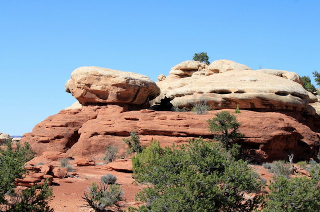
Along the Elephant Butte road, we saw the rock formations that caused this area of Canyonlands National Park to be called "The Needles".
 |
| Rock formation along the Elephant Butte road |
 |
| They call this type of formation a 'mushroom' for some reason |
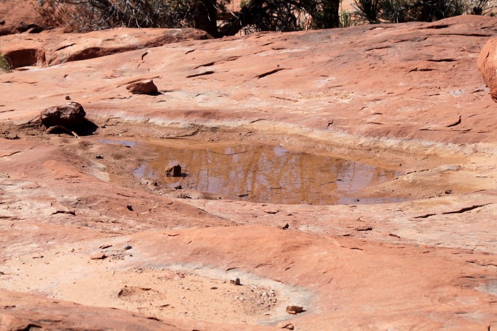
 |
| A pothole still filled with water |
 |
| Mud flakes and cracks in a recently dried up pothole |
 |
| Alternating red and white sandstone |
 |
| Why they call this part "The Needles" |
 |
| The road goes by several of these towering, overwhelming rock outcroppings |
 |
| The erosion patterns are really cool |
 |
| A single needle |
 |
| More coolness. Everything in the geology of the area had to occur in order for this to exist |
 |
| Needles forming |
 |
| More awesomeness |
 |
| Looks like a camel |
 |
| Surrounded by a wonderful landscape |
Second Stop: The Potholes Trail
Potholes in sandstone are an erosion feature that develops when slightly acidic rainwater collects in a low spot in the rock and over time dissolves material and creates a bigger depression. After a rainstorm and these potholes fill with water, a mini-ecosystem develops that might include small shrimp and other aquatic animals. The life cycle of these animals is a few days only. In that time they lay drought resistant eggs which lay dormant in the dirt until the next rain. Then it starts all over again. As the potholes get bigger, they begin to fill with dirt which is called 'cryptobiotic soil'. The signs asked us not to step in the potholes because they are very delicate. I saw footprints all over the place in the potholes but I didn't make any. Eventually little gardens grow in the filled in potholes. Some of the gardens looked planned even though I knew they were not.
The trail was marked like all the others in Canyonlands with cairns.
 |
| Trail marker |
 |
| The trail skirts around this |
 |
| Potholes |
 |
| This tree found a spot to grow |
 |
| These formations remind me of the set design of Ape City in the original 1968 Planet of the Apes |
 |
| Another spot where you know why they call this part of the park "The Needles" |
 |
| This tree didn't make it |
 |
| Desert Indian Paintbrush |
 |
| I believe this is some kind of milkvetch |
 |
| Pothole garden |
 |
| More potholes |
 |
| More needles |
 |
| Large butte and mesa |
 |
| The Hot Chick under the big boulders |
 |
| Oh wait, another cairn |
 |
| Me being naughty |
 |
| Weird erosion patterns |
 |
| Cairn |
 |
| Pre-petrified ripple marks |
 |
| Cryptobiotic soil |
Third Stop: Big Spring Canyon Overlook
It was getting late in the day and we were getting a little "hangry", but we soldiered on to the last stop. Big Spring Canyon Overlook is really a great excuse for a bunch of trailheads, each going different directions to different things. Since neither of us are currently in hiking shape, we put these hikes on a 'do this later' calendar. If you are going to have a trailhead, though, it should look like this one. It was amazing. We tromped around a few formations and spent about a half hour here. We mostly forgot our hunger because it was so cool.
 |
| Formations at Big Spring Overlook |
 |
| The canyon carved by The Colorado River |
 |
| The photo doesn't show how massive this is, nor does it show how insignificant we are compared to it |
 |
| More of the features here |
 |
| I don't normally post photos with camera flare, but I liked this one |
 |
| Almost looks manmade |
 |
| This is the same river that later carves the Grand Canyon in Arizona |
 |
| Weird |
 |
| I called this rock the Monkey Sphynx |
 |
| More massive rocks |
 |
| Dead tree in the middle of nowhere |
 |
| Remember how big I said the rocks were? Here's the Hot Chick for scale |
 |
| More big rocks |
 |
| I liked the composition here |
 |
| Weird erosion patterns |
 |
| More evidence of why this is called "The Needles" |
Last Bit of Canyonlands National Park
As we drove out we saw a feature called "Wooden Shoe Arch." Wait a minute, I thought we were going to see Arches the next day. Turns out there are a bunch of arches in Canyonlands National Park as well. There are more sandstone arches in Utah than anywhere else on the planet. It's pretty incredible.
 |
| Wooden Shoe Arch |
 |
| Another cool rock |
 |
| Outside the park, the snowcapped mountains in the background |
 |
| More coolness |
 |
| I hated leaving |
 |
| The sun was just about right |
As we drove out of the park, the sun was just about to the golden hour. We drove into Moab for dinner and the DJ on the radio sounded like a hippie chick. She identified herself as 'Moonbeam.' She was playing oldies many of which happened to be from the eighties. I have to come to grips with the fact that music from my generation is now considered 'oldies'.